History
Montgomery County Municipal Utility District No. 140 (“MUD 140” or the “District”) was created pursuant to Acts 2013, 83rd Leg., R.S., Ch. 307 (H.B. 1492), Sec. 1, eff. June 14, 2013, as codified in Chapter 8425, Texas Special District Local Laws Code (the “Act”). The District operates under Chapters 49 and 54 of the Texas Water Code, Article XVI, Section 59 and Article III, Section 52 of the Texas Constitution. The District lies wholly within Montgomery County, Texas, and the extraterritorial jurisdiction of the City of Conroe (the “City”). The District is approximately 35 miles north of downtown Houston and located about midway between Interstates 45 & 69 just south of State Highway 99. The West Fork San Jacinto River forms the western boundary and FM 1314 is to the east of the District. The District is accessible from State Highway 99.
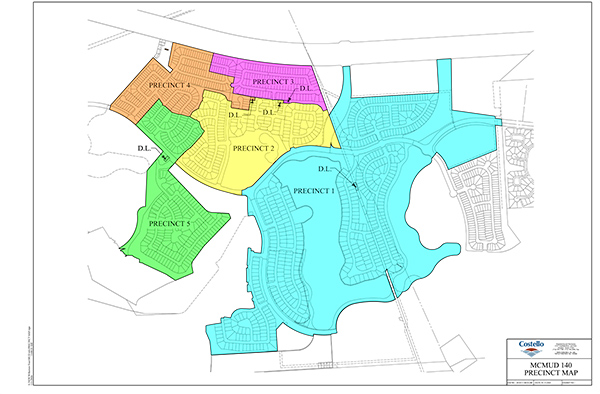
The District included 1,207.52 acres of land at creation. The District divided into six municipal utility districts as authorized by Section 8425.125, Texas Special District Local Laws Code, pursuant to a Corrected Order Dividing District into Six Districts dated September 1, 2020. After such division, the District included 532.50 acres of land. The District later excluded from its boundaries a total of 202.168 acres of land pursuant to an Order Excluding Certain Land from the Boundaries of Montgomery County Municipal Utility District No. 140 dated April 6, 2021. After the exclusion, the District included, and the present boundaries of the District include, 330.332 acres of land.
District Service Area